Day 3: Tapawera-Murchison
Last night was in a rather nice and exceptionally cheap room, attached to a bottle store/pub. The pub closed at 9 so I had to finish my homework in my room. But in hindsight this was a standout! I’m staying tonight in a hostel that costs somewhat more and the quality is somewhat less.
Today started on the Great Taste Trail, which is well maintained and easy going. I'd been on it for most of yesterday, and there were some really pretty sections; it also meant I wasn't on State Highway 6 which I like. Unfortunately we parted ways early in the morning, but the route was on a quiet asphalt backroad so it's fine.
The weather was excellent. Bright blue skies, not too hot, maybe too much sun, but I should not complain. Quiet roads, almost no traffic. Past lots of farms. The road turns to gravel and heads into trees and into the mountains. A 4x4 with three people buzzed past, going way too fast. A helicopter is flying very low over the ground spraying something. I can't get a good photo.


From left to right: setting out. Various NZ back country locations, I thought they looked good. The last one is the remains of a railway station; the rails have all been torn up but sadly there isn’t a rail trail.
We rejoin State Highway 6 for 15km. This isn't a good section: there isn't enough space on the side of the road. The drivers were considerate though, and the traffic was mostly light enough so they could put a wheel over the centerline.
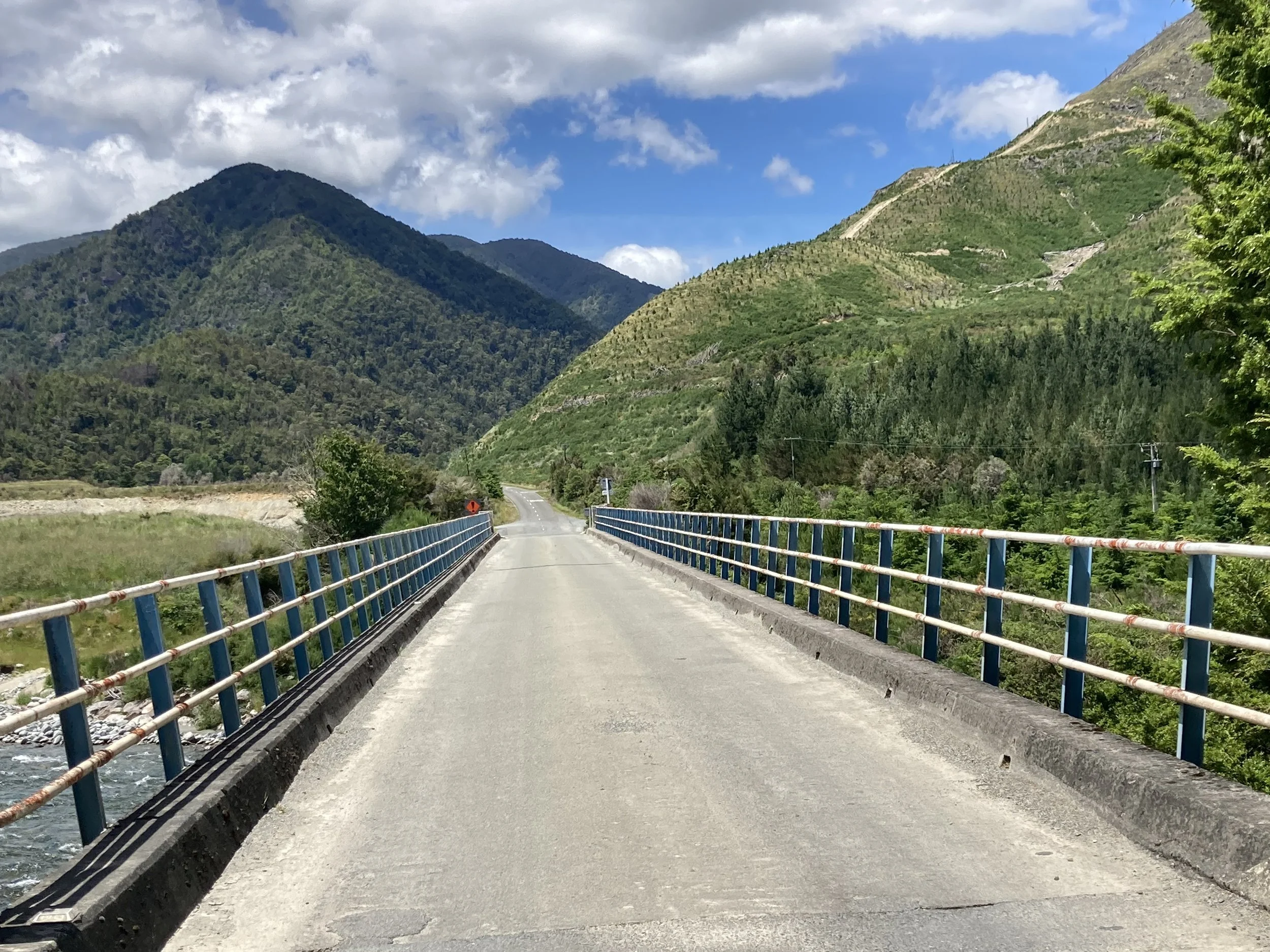
The the route takes a left, goes over the Buller river, and into the back country. There's a big climb towards the end, it's not as big or high as the Maungatapu saddle route but I'm still wondering if this is the right choice. It's a 200m climb, 10% gradient - but the map app thinks the road is in better shape. Hopefully it'll be OK.
It is a hot day. There's a bridge over the Te Kauparenui river and kids are jumping off it into the water. Tempting to join them... but I'd be cycling in wet shorts, which I'd rather not do. So I have to give it a miss.
The road is good gravel, mostly among trees so it's shaded. We’re past farms now; the only turnoffs are to old, firmly closed gates with no visible road beyond them. Large back-country fields.


From left to right: bridge to the backcountry over the Buller river. More NZ views. Plus selfie. This is the view from the top, note the new mailbox. The last ford of the day. Final section out of the mountains.
Then it's the big final climb. It isn't too bad! I can't cycle all the way up because my drinks bag keeps falling off the back and onto the wheel and I have to stop and sort it out. And getting started on a steep narrow slope is tricky, no death drops but going into a rough gravel shoulder is also a fail. So I do push the bike a bit. At the top is a recently installed mailbox and driveway, leading to a new modern house. Someone really wanted to live out here.
The downslope is no problem, thankfully. There’s a few fords; one has some metal bars to channel the water and I get a wet foot navigating past. No vibe-corroding uphills. Then it’s asphalt, mostly downhill all the way to Murchison.
But it’s good! I got to Murchison almost exactly when Komoot predicted.
Tonight I'm staying in an unattended hostel, quite like the ones in Scandinavia. I’ve been emailed the front door key and directions to my room. There’s a few other people staying so it’s not quite the full antisocial experience from the European Divide. But it’s bringing back some memories.
However… it’s Sunday night in a small town and nothing is open. None of the cafes, not the restaurants, not even the bar. So dinner will be a challenge. Time to go figure it out.