Day 7: Greymouth-Hokitika
Today I was following the Wilderness Trail all day, and it'll probably be the best day of the tour. I don't think I went on a State Highway at all, ever, I didn't have to worry about traffic, I didn't need to look ahead to anticipate the road shoulder disappearing. And there was a bit of rail trail!
So today has set quite a high bar.
Since I'm talking this thing up, here's the website: https://westcoastwildernesstrail.co.nz/
It runs from Greymouth to Ross, although I stopped in Hokitika which is about two hours before the end.
Anyway, rather than giving a chronological breakdown here's the highlights.
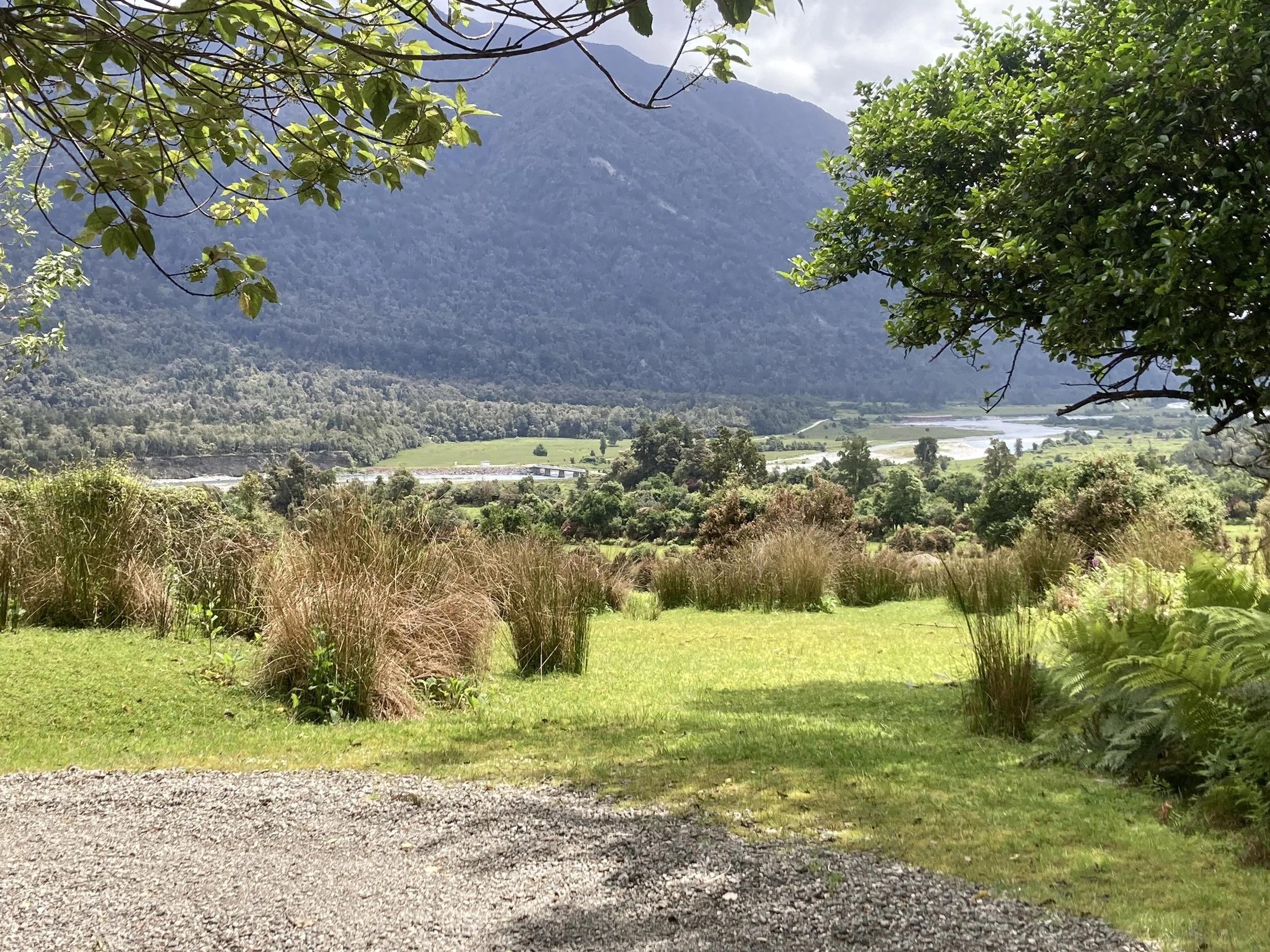


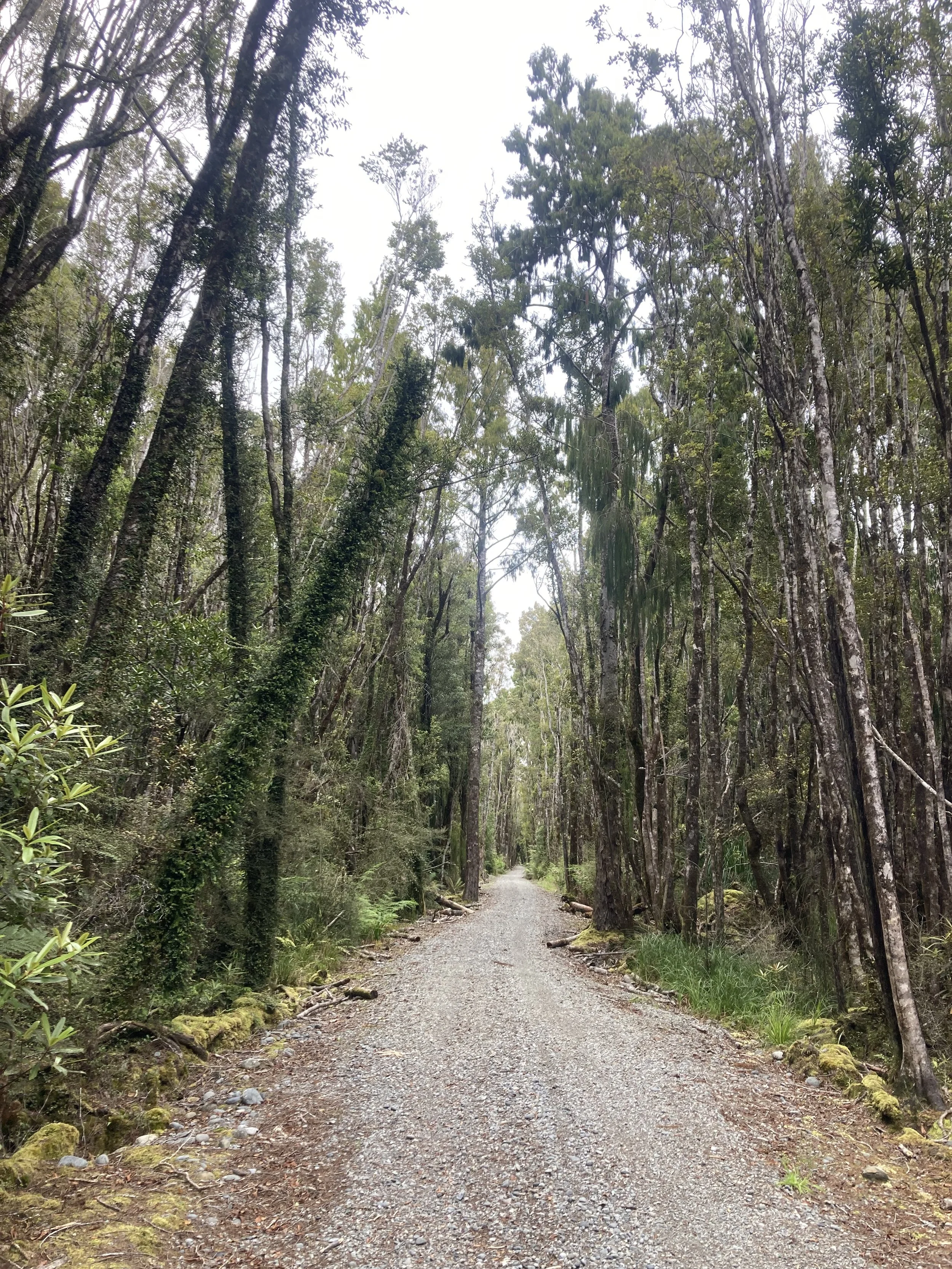
Switchbacks (-42.8293, 171.2454): The trail was nice white gravel, on a nice grassy slope with an excellent view of the Arahura river valley. Great view, great track. Wish I had taken more pictures!
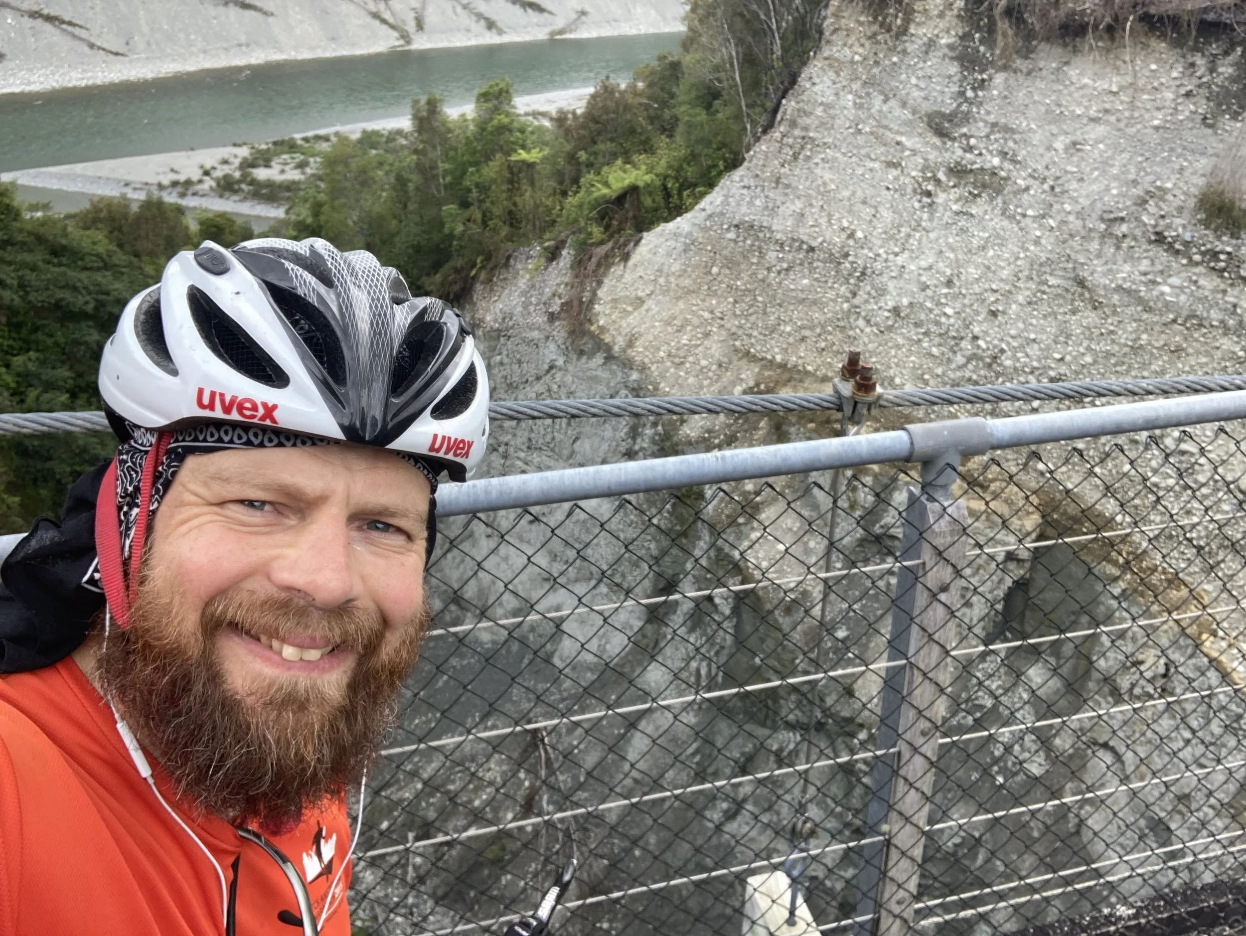
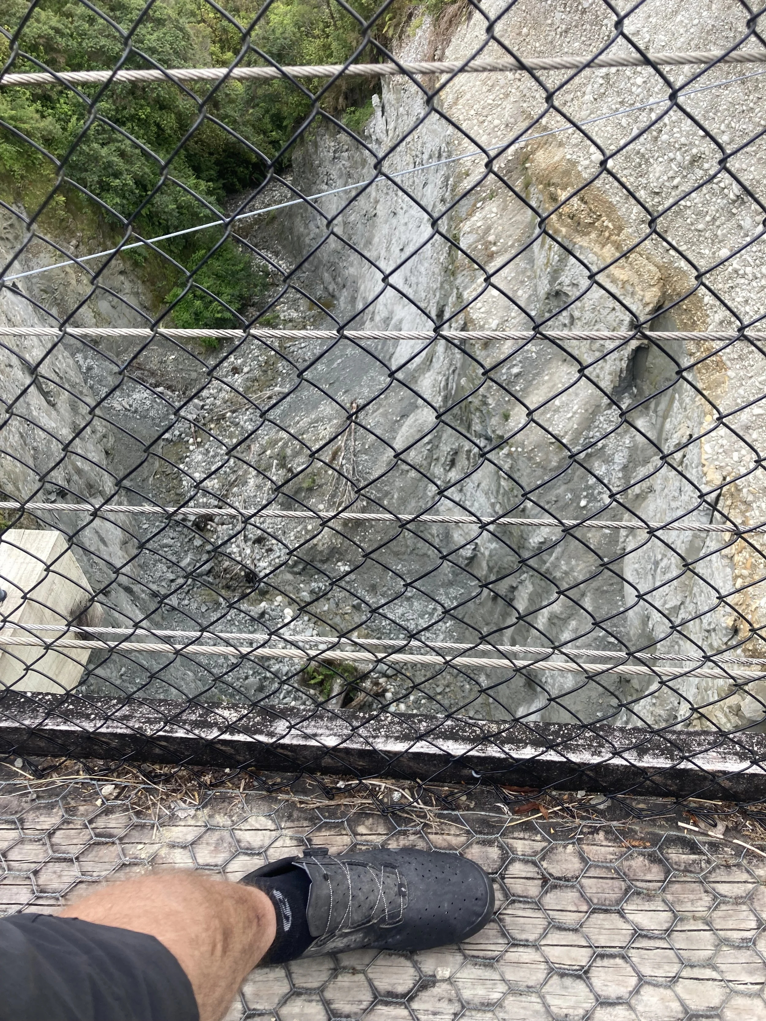
Kumera Chasm Suspension bridge (-42.6152, 171.1753). Suspension bridges always make the day better. This one was wide enough to cycle on, light enough to sway excitingly when I did so, and was surprisingly high.
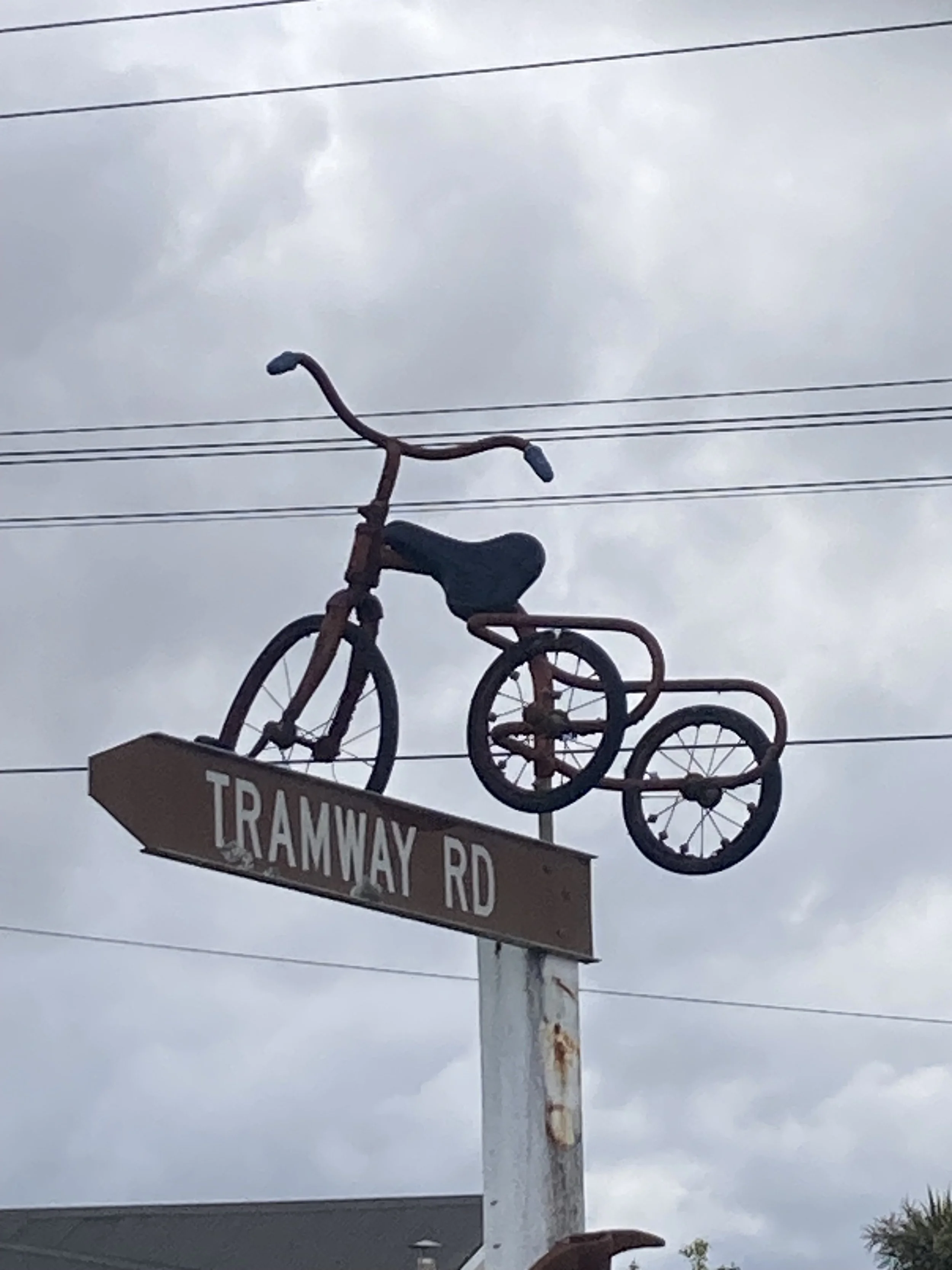
Tram trail (-42.5742, 171.1497). Like a rail trail, but for trams. There was a rail system in the area, constructed for access to the gold fields. It all ended in 1893 when the coastal rail route opened. But parts of the route seem to now be bike path. Which means no steep inclines, no sharp curves, and good cycling.

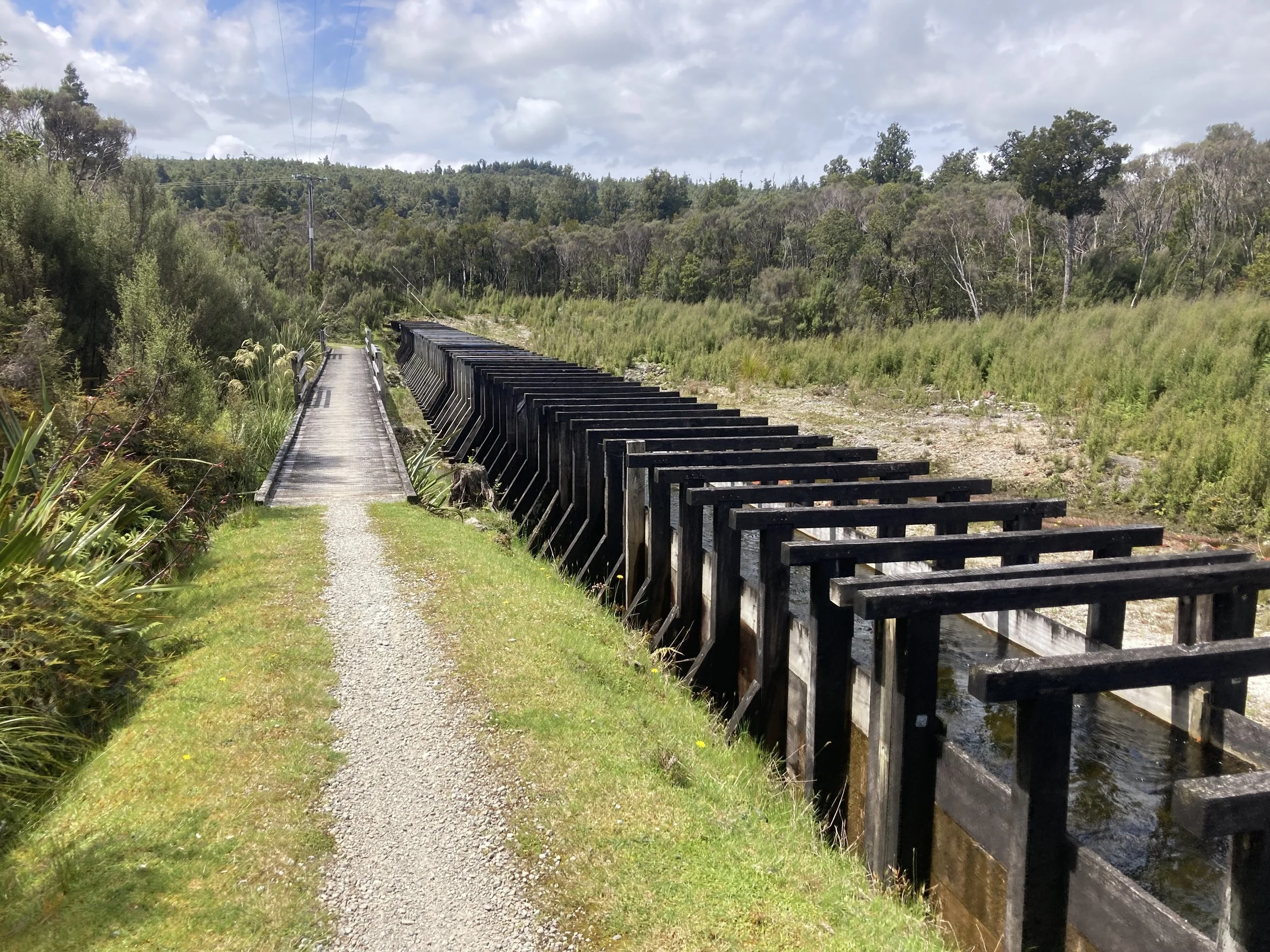
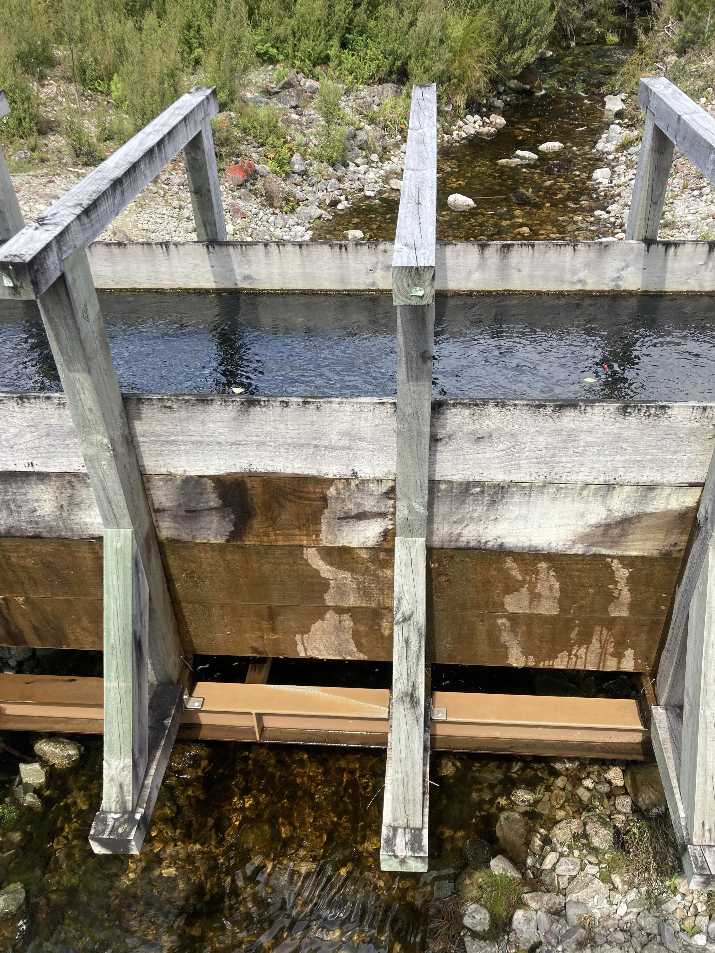

Kaniere Water Race Walkway (-42.7985, 171.1389). A small 10km long canal hand-built in 1875, initially to carry water to the gold field (so the water could be sold to miners). Later used to generated power for mining. Then for a gold dredge. Then to supply homes.
"Canal" isn't a great description: it's about a meter wide, with braced timber walls. In some places, a full wooden chute to carry the water. There's regular signs warning of danger from drowning, but in theory you could float down it like a water ride at a theme park...
At one point it was carried over another stream! Great stuff. (For NZ in 1875. Dutch infrastructure fans can please keep their comparisons to themselves at this time, please.)
Ayers Rock (-42.7869, 171.2708). Not Uluru. Not even a little bit. Is this some in-joke? Let's imagine so.
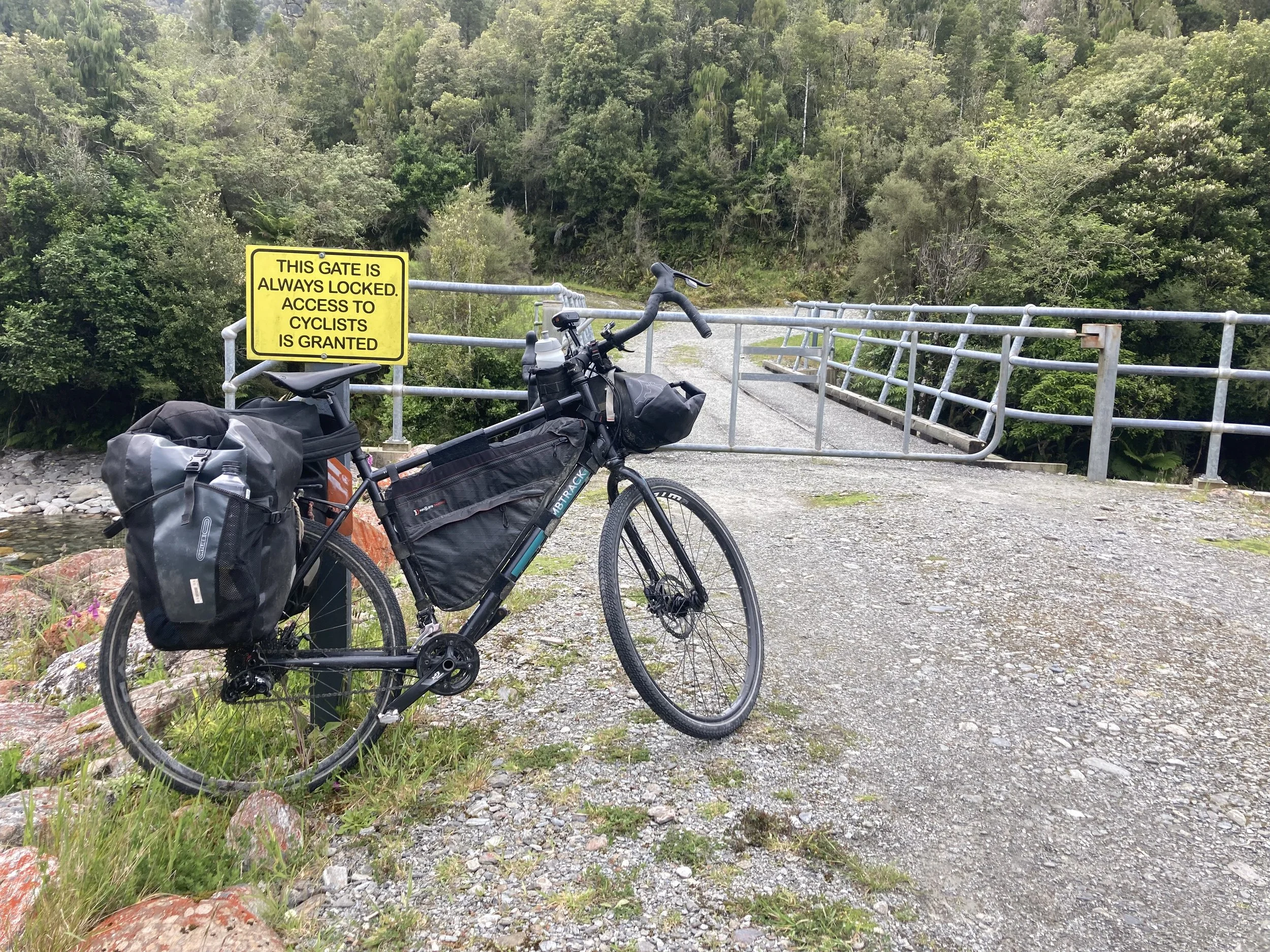
This Gate Is Always Locked. Access To Cyclists Is Granted (-42.8123, 171.2440). The regular route was blocked off due to high water, and I had to take a detour. This included a gate that was Always Locked but was built with spaced bars and generously large gaps to make it clear it's more to keep cars out. I unloaded the bike but couldn't fit through a gap, but there was space at each end.
That's quite a lot of highlights. I forgot the beach section! And not being amongst traffic was especially good.


From left to right: Taramakau Bridge has a great cycle lane. Why is the trike being celebrated? Trail view. Boardwalk. Selfie practice. Excitingly landscaped banks on the way upstream. The route is going places. “Cowboy Heaven”, a tourist trap that fell into decay and new owners are trying to revive. Arahura bridge.
So a really excellent day, I live in hope that there's another one this good coming up this trip.